Data
Overview
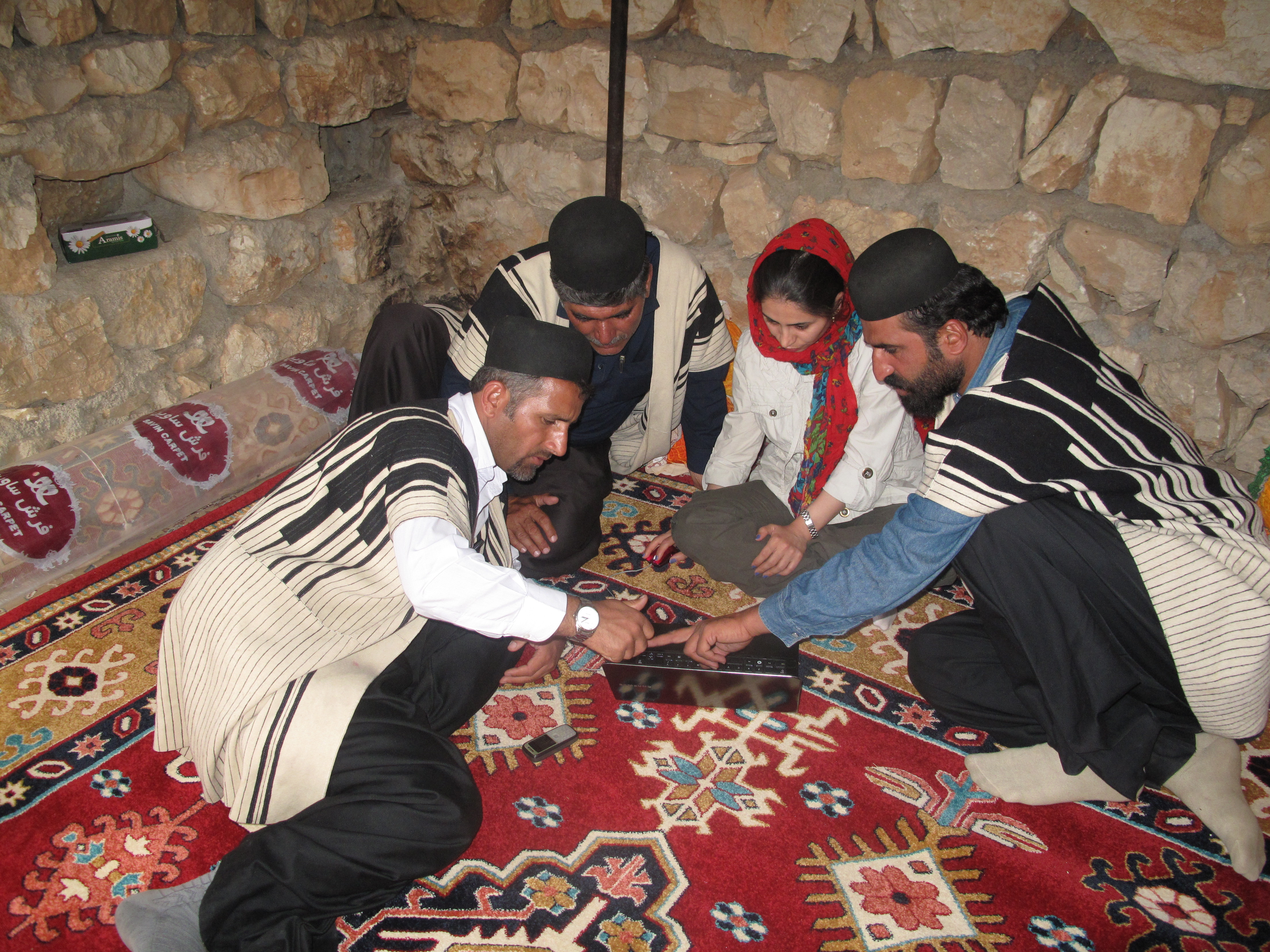
Photo credit: CENESTA/Iran
LandMark: The Global Platform of Indigenous and Community Lands displays georeferenced information on collectively-held and used lands worldwide. It consolidates the numerous ongoing local, national, and regional efforts to map and document indigenous and community lands within a single global platform. The platform distinguishes indigenous lands from other community lands in part because various international human rights instruments specifically grant Indigenous Peoples a range of rights, including rights to their land and natural resource (see Definitions).
LandMark aims to display the best-quality data available from reputable organizations and recognized experts, but does not endorse or verify the accuracy of any dataset (see Data Quality). The platform includes maps and data on indigenous and community lands that are publicly available as well as information directly from individuals and organizations with their permission as detailed in a data-sharing agreement. The contributing individuals and organizations, which are documented in the Data Providers tab, are fully responsible for the accuracy of the data. Users are encouraged to report any errors, omissions, or inconsistencies to the LandMark Operational Team () and the appropriate data provider. Amendments will be made on a periodic basis.
The data on LandMark is offered at multiple scales: National level and Community level. The National level data is comprised of two datasets that are based on research (e.g., legal reviews, literature reviews, interviews). For each country, the National level data layers show: 1) the percent of land in that country held or used by Indigenous Peoples and communities; and 2) the tenure security of indigenous and community land based on the evaluation of ten indicators. At the Community level, LandMark provides a common platform for hosting data on the locations of indigenous and community lands as provided by individuals and organizations around the world with expertise in land rights, including often in mapping and documenting rights.
Definitions

Photo credit: Walter Wust/Peru
The following definitions apply for the purposes of organizing and interpreting data on LandMark:
Communities are groupings of individuals and families that share common interests in a definable local land area within which they normally reside. Communities vary in size, identity, internal equity, and land use systems, and may distribute rights to land in different ways. However, communities are similar in these ways: 1) They have strong connections to particular areas or territories and consider these domains to be customarily under their ownership and/or control. 2) They themselves determine and apply the rules and mechanisms through which rights to land are distributed and governed. The rules themselves alter over time, as do the mechanisms through which these are upheld (e.g. from autocratic chiefs to committees). Many rules are customary, based on tried and tested customs followed by forebears. Others are new, developed by the community to address new challenges (e.g., land shortage) or to be consistent with constitutional rights of members who are also citizens of modern states (e.g. as relating to women’s land rights). 3) Collective tenure and decision-making characterize the system. Usually, all or part of the community land is owned in common by members of the community and to which rights are distributed. Sometimes, community lands are traditionally entirely subdivided into family lands but over which the community exercises authority, establishing the means by which family rights are recognized, held, used, and transferred.
Indigenous Peoples are the sector of the world’s communities who identify themselves as Indigenous Peoples. They adopt this definition on various grounds, such as having stronger relations to their land than other nationals, longer origins in the locality, or distinctive cultures and ways of life that run special risks of being denied or lost in modern conditions. Many communities consider themselves indigenous to the locality but do not define themselves as Indigenous Peoples. This is especially so in Africa and Asia. Moreover, there are many commonalities in land tenure and governance between Indigenous Peoples and other communities. The distinction between Indigenous Peoples and other communities is made on LandMark mainly because their rights may be subject to special national legislation and which must be reviewed distinctly from laws affecting the rights of other communities. In addition, Indigenous Peoples are the subject of specific internationally-recognized collective rights, including rights to land and natural resources (e.g., International Labour Organization Convention 169, United Nations Declaration on the Rights of Indigenous Peoples).
Community Lands are all lands that fall under the customary governance of the community whether or not this is recognized in national law. Community land is variously described as the community domain, community land area, community territory, or other terms (e.g., Tanzania refers to village lands, Ghana to customary lands, China to collectives, Cambodia refers to indigenous lands, etc.).
Indigenous Lands or territories refer to the collectively-held and governed lands (and natural resources) of Indigenous Peoples. As with other community lands, some indigenous lands may be allocated with group consent for use by individuals and families. Other indigenous land is managed as common property. In some cases, indigenous land is held by individuals or families (e.g., New Zealand). Traditional indigenous territories are estimated to encompass up to 22 percent of the world’s land surface.[1]
Commons are areas maintained as the communal property of all community members. Some communities and Indigenous Peoples hold and use all of their land communally. This is usual among hunter-gatherers and mobile nomads who practice transhumance (i.e., moving livestock from one grazing location to another in a seasonal cycle). Many communities, however, do not use all of their land communally. While the community exercises jurisdiction over the entire land area, it may be the case that each family possesses its own distinct part of the domain. Or the community may draw a distinction between lands that it has allocated to families for residence and permanent farming, and other lands which it purposely retains the shared property of all members, which is referred to as commons, commonage, or common property. Lands for grazing and wildlife, forests and woodlands, mountaintops, sacred localities, and lakes and streams within the community land are usually retained purposely as collective property commons to which all members have use rights.
Land Rights are the rights of individuals or groups of peoples, including Indigenous Peoples and communities, over their land. The bundle of rights can include the rights of access, withdrawal, management, exclusion and alienation. The bundle can also include rights to various natural resources on and below the surface of the land (e.g., trees, wildlife, water, minerals). The source of these rights can be statutory law or customary law.
Customary Land Rights are usually synonymous with indigenous and community land rights and are appropriately used interchangeably depending upon the context. This is because indigenous-based and community-based systems of landholding are usually traditional or customary.
Land Tenure is the legal or customarily-defined relationship among people—as individuals or groups people—with respect to land. It includes the full range of social relationships between people and communities with regard to accessing, possessing, controlling and transferring land and natural resources. Land tenure systems determine who can use what resources for how long and under what circumstances.[2]
Customary Tenure means community based systems of land ownership and administration that have longstanding origins in the norms and practices of communities and may go back centuries. Customary law refers to the rules that a community observes. Although the term “customary” is not uniformly in use, it is important to note as many countries make reference in their constitutions to customary tenure and customary law. Wily (2011) estimates that customary tenure extends over at least 8.54 billion hectares - an estimated 65 percent of the global land area - involving 1.5 billion people.[3]
Land Tenure Security is the certainty that an individual’s or community’s rights to land will be recognized by others and protected in cases of specific challenges.[4] The attributes and sources of tenure security may vary from context to context. To a large extent, land tenure security is what people and communities perceive it to be.[5]
Indicative Areas of Indigenous and Community Land Rights represent areas where indigenous and community lands likely exist but the clear delimitation, recognition and/or documentation status of these land rights are not available at this time. These maps will transition to the Indigenous Lands or Community Lands layer once more information becomes available
[1] Nakashima, D.J., Galloway McLean, K., Thulstrup, H.D., Ramos Castillo, A. and Rubis, J.T., 2012. Weathering Uncertainty: Traditional Knowledge for Climate Change Assessment and Adaptation. Paris, UNESCO, and Darwin, UNU, 120 pp.
Sobrevila, C., 2008. The Role of Indigenous Peoples in Biodiversity Conservation: The Natural but Often Forgotten Partners. World Bank: Washington, DC.
[2] Food and Agriculture Organization (FAO). 2002. Land Tenure and Rural Development. FAO Land Tenure Studies No. 3. Rome: FAO.
[3] Alden Wily, L., 2011. The Tragedy of Public Lands: The Fate of the Commons under Global Commercial Pressure. International Land Coalition: Rome.
[4] FAO, 2002, ibid
[5] FAO, 2002, ibid
Data Quality
Photo credit: James Anderson, WRI
The data and information displayed on LandMark are assembled from many different sources and contributors. To ensure high-quality and accurate information, the Operational Team and Steering Group have instituted several quality-control measures.
- Data Sources. Only data from individual experts and established organizations that are well-recognized and respected in the land rights community – and are vetted by LandMark’s Operational Team - are displayed on the platform. To ensure transparency, the name of each source or contributing individual or organization is available in the attribute table, accessible by clicking on the specific geographic feature in the interactive map, and in the Data Providers tab. These parties are fully responsible for the accuracy and quality of the data they provide. Any errors are the responsibility of the data providers, although LandMark can serve as an intermediary in informing providers of inaccuracies. Users may contact the data provider directly or contact the LandMark Operational Team to convey comments or questions about the data displayed.
- Data. LandMark’s Operational Team reviews all data for quality and consistency before the information is posted on the platform. LandMark does not display boundaries of indigenous and community lands that have been digitized from static (e.g., paper) maps because of the difficulty in ensuring geographic accuracy. In most cases, the Operational Team also engages country experts to review boundary data before it is posted. Data acquired from the literature must be published by reputable organizations and/or appear in peer-reviewed journals that have their own quality-control processes. Data from LandMark-initiated research is also subject to a quality-control process that involves internal and external reviews.
- Methods All data displayed on LandMark are associated with detailed documentation and/or data collection/analysis methods to allow for traceability and verification of the information. Documentation for all layers includes the source of the data and the data provider. The attributes for community level data also includes, when available, the methods of collection (e.g., hand-held GPS, transcribed from land title) and the scale at which data were mapped, to help convey the accuracy and quality of the spatial information (see Community Level Data and Methods and Data Quality Standards). The methods and criteria behind the National level data layers are described in detailed documentation available in National Level Data and Methods.
- Updates. Community level data are updated as new information is received from data providers, or approximately once per month. New National level data are uploaded to LandMark approximately once every four to six months, while existing data are updated approximately once per year. The date that boundaries or attribute information were last updated by the data provider, as well as the date the data were uploaded to LandMark, are available in the attribute tables for all data layers.
Additional detail on the data quality standards for Community Level Data can be found in this document. The maps displayed on LandMark should be treated as a first, and not a singular or final, step in assessing the locations of lands held or used by Indigenous Peoples and communities. Many Indigenous Peoples and communities have not mapped their lands, and LandMark does not include all maps that have been prepared by governments, civil society organizations, Indigenous Peoples, communities or other stakeholders. Moreover, boundaries can change over time and with changing local circumstances. As a result, new data are added and existing data are updated on the platform on a regular basis (see above). Proper due diligence to verify boundaries (e.g., groundtruthing, site visits, interviews) is necessary for any actions that may affect Indigenous Peoples and communities. Please refer to the Terms of Use for more information on the use of data and information displayed on LandMark.
Data Completeness
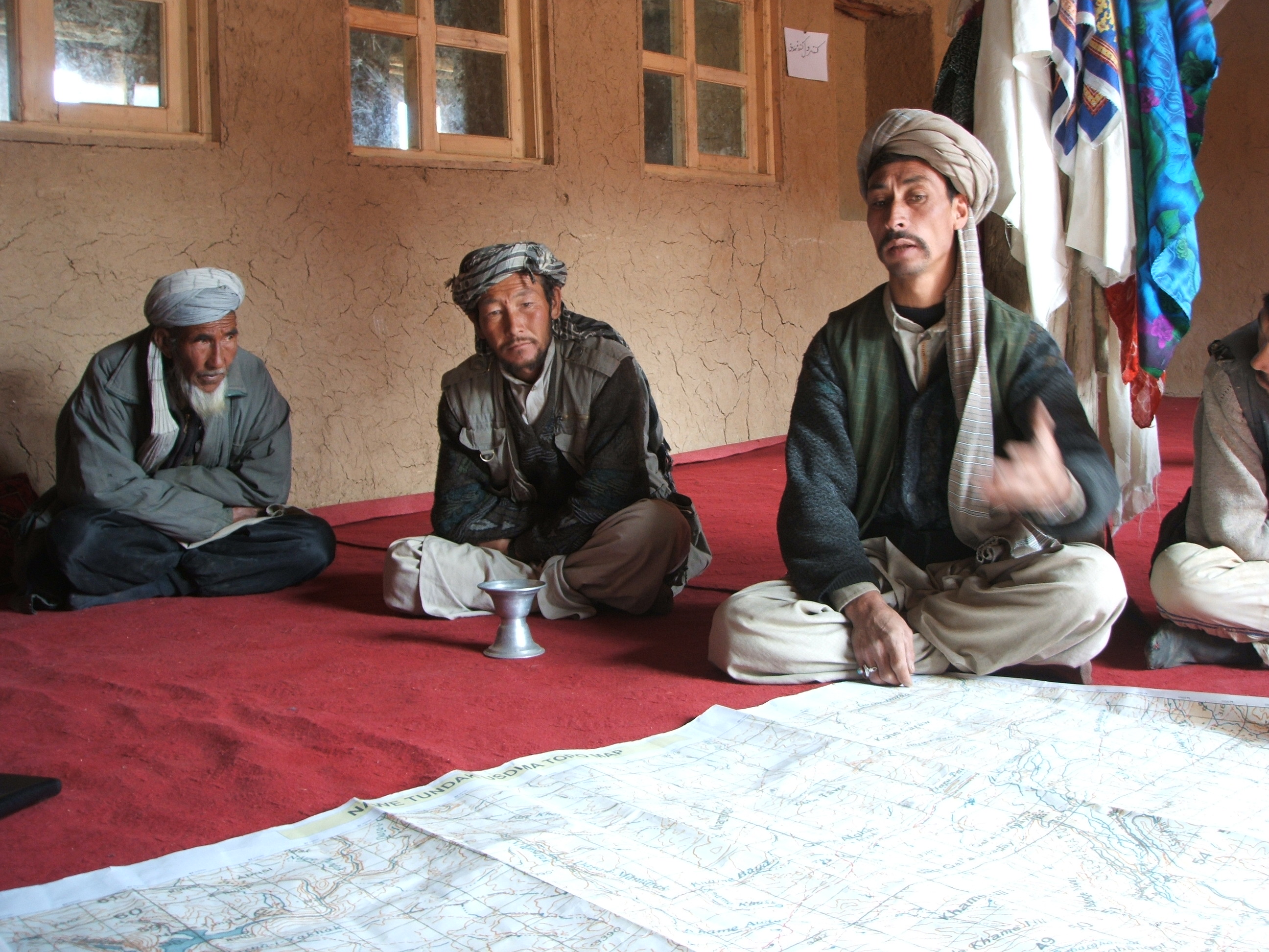
Photo credit: Liz Alden Wily
LandMark is a work in progress. The current Community level and National level data layers have gaps in data coverage, and LandMark‘s Steering Group envisions developing a number of additional data layers to add to the platform in the future. The Operational Team is continuing to collect maps from governments, civil society organizations and other data holders to populate the Community level data layers. LandMark‘s Operational Team is also locating and/or generating new data through research to populate the National level datasets on the ‘Percent of Indigenous and Community Lands’ and the ‘Indicators of the Legal Security of Indigenous and Community Lands.’
A considerable amount of the world’s land is occupied and used by Indigenous Peoples and communities, although we do not know the precise amount. Liz Alden Wily estimates that customary, community-based tenure systems extend over at least 8.54 billion hectares - an estimated 65 percent of the global land area - involving perhaps 1.5 billion people.[1] Traditional indigenous territories alone are estimated to encompass up to 22 percent of the world’s land surface.[2]
Only a fraction of this land, however, is recognized or registered by the state. The Rights and Resources Initiative estimates that 18 percent of the world’s land is formally recognized as either owned by or designated for Indigenous Peoples and communities.[3] The International Federation of Surveyors, Global Land Tool Network and United Nations Human Settlements Programme (UN-HABITAT) notes that, “(m)ost developing countries have less than 30 percent cadastral coverage. This means that over 70 percent of the land in many countries is generally outside of the land register.”[4]
Global coverage of Community level and National level data layers is the long-term goal but it is far from being achieved. Geospatial data for many indigenous and community lands does not exist or has not been located by LandMark‘s Operational Team. The National level ‘Percent of Indigenous and Community Lands’ layer seeks to address the issue of missing Community level data by showing how much of a country is held or used by Indigenous Peoples and communities, as determined through research and literature review. Even though a country may not have National or Community level data displayed on the platform, Indigenous Peoples and communities may still hold or use land in that country. The absence of data does not indicate the absence of indigenous or community land.
LandMark is continuously seeking new data to fill in the gaps in data coverage. If you or your organization can help, please contact us.
[1] Alden Wily, L., 2011. The Tragedy of Public Lands: The Fate of the Commons under Global Commercial Pressure. Rome: International Land Coalition.
[2] Nakashima, D.J., Galloway McLean, K., Thulstrup, H.D., Ramos Castillo, A. and Rubis, J.T. 2012. Weathering Uncertainty: Traditional Knowledge for Climate Change Assessment and Adaptation. Paris, Paris: UNESCO and Darwin: UNU.
Sobrevila, C., 2008. The Role of Indigenous Peoples in Biodiversity Conservation: The Natural but Often Forgotten Partners. Washington, DC : World Bank.
[3] Rights and Resources Initiative. 2015. Who Owns the World’s Land? A Global Baseline of Formally Recognized Indigenous and Community Land Rights. Washington, DC: RRI.
[4] Lemmen, Christiaan. 2010. The Social Tenure Domain Model A Pro-Poor Land Tool. Copenhagen: International Federation of Surveyors.
National Level Data and Methods
This image was taken with the consent and cooperation of the Yudja Indigenous people and the authorization of the Brazilian National Indian Foundation - FUNAI
The National level data is comprised of two data sets that are based on research and literature reviews. For each country, it shows: 1) the percent of land in that country held or used by Indigenous Peoples and communities; and 2) the tenure security of indigenous and community lands based on evaluation of several legal indicators. The geographic boundaries for presenting the national level data on LandMark are sourced from the GADM Database of Global Administrative Areas.
Percent of Indigenous and Community Lands
These maps show the estimated area of land held or used by Indigenous Peoples and non-indigenous communities per country as a percentage of the country’s total land area. The data are divided into three categories for visualization on the global map: acknowledged by government (i.e., lands recognized by the State), not acknowledged by government (i.e., lands held or used but not recognized by the State), and total (i.e., sum of lands held or used, independent of recognition status). The percentages are calculated by dividing the total land area of the country (calculated in GIS using the GADM Database of Global Administrative Areas) by the estimated area of the land held or used by Indigenous Peoples and communities.
The methods or resources used for estimating the amount of land held or used vary for different countries or regions of the world. They may be based on information collected from published reports and websites of credible organizations, the gray literature of experts and land rights organizations or, when there is no information published, the estimates of experts in combination with a method that excludes all non-indigenous and community lands (e.g., urban land, protected areas). The following documents, organized by region, provide more details on the methods and resources used in estimating the percentages for each country:
The various layers - estimates for total percent of land held or used by Indigenous Peoples and communities as well as the percent that is acknowledged by govt or not acknowledged by govt - can be display on the map through the layer selection panel. The estimates are displayed on the map according to categories representing a range of percentages. The percentage value and sources of the estimate can be viewed in the attribute table by clicking on a country in the interactive map. A further breakdown of the data into estimates of lands held or used by Indigenous Peoples only and communities only are under development.
For some countries and categories, “No data” is displayed in lieu of a percentage. No data represents one of two scenarios: 1) there was not enough information found through research to make an estimate; or 2) the country or category has not yet been evaluated. The Notes field in the attribute table for each country and category provides additional information on the specific circumstance. The Notes will recognize if only partial information is available.
| Attribute Table for Percent of Indigenous and Community Lands | |
|---|---|
| Percent of country area held or used by Indigenous Peoples and communities | The total amount of land held or used by Indigenous Peoples and communities in the country as a percentage of the country’s total land area. The information is further subdivided into the percent of indigenous and community land that is formally recognized and the percent that is not formally recognized. All estimates include sources and dates. |
| Notes | Additional information regarding the estimates. |
| Date uploaded | The date that the data were posted on LandMark. |
| More info | A web link to more detailed information. |
Indicators of the Legal Security of Indigenous and Community Lands
This data is characterized by a series of ten indicator questions that point to the security of land tenure for Indigenous Peoples or communities as established in national laws. Based upon the experience of the LandMark Operational Team and with inputs from the Steering Group, the ten indicator questions listed in the table below were identified as the most important to consider based on their indication of the strength of laws in recognizing indigenous and community land and natural resource rights.
In many countries, especially in Africa, one set of national laws applies to all collective tenure types. In some countries, however, indigenous lands, non-indigenous community lands and perhaps other collective tenure types are regulated by separate national laws. In such cases, the indicators are assessed separately for each collective tenure type that is governed by a different legal framework. This is important, because national laws may better recognize and protect one type of collective tenure than another type. The references to each law and ethnic group are included in the attribute table that is available by clicking on a country in the interactive map.
| Indicators of the Legal Security of Indigenous and Community Lands | |
|---|---|
| Category | Indicator |
| 1. LEGAL STATUS | Does the law recognize all rights that Indigenous Peoples or communities exercise over their lands as lawful forms of ownership? |
| 2. LAND RIGHTS AND COMMON PROPERTY | Does the law give indigenous or community land rights the same level of protection as the rights under other tenure systems? |
| 3. FORMAL DOCUMENTATION | Does the law require the government to provide Indigenous Peoples or communities with a formal title and map to their land? |
| 4. LEGAL PERSON | Does the law recognize the Indigenous Peoples or community as a legal person for the purposes of land ownership? |
| 5. LEGAL AUTHORITY | Does the law recognize the Indigenous Peoples or community as the legal authority over the land? |
| 6. PERPETUITY | Do the law and formal title recognize that indigenous or community land rights may be held in perpetuity? |
| 7. RIGHT TO CONSENT BEFORE LAND ACQUISITION | Does the law require the consent of Indigenous Peoples or communities before government or an outsider may acquire their land? |
| 8. RIGHTS TO TREES | Does the law explicitly recognize that indigenous or community land rights include the rights to all trees on the land? |
| 9. RIGHTS TO WATER | Does the law explicitly recognize that indigenous or community land rights include the rights to local water sources on the land? |
| 10. LAND RIGHTS IN PROTECTED AREAS | Does the law uphold indigenous or community land rights in the ownership and governance of national parks and other protected areas? |
The assessment of each indicator is based on a review of relevant national laws, including the constitution, statutes, regulations, and high court cases, to the extent they are available. In countries with a federal system, such as India and Australia, the review is limited to national or federal laws, not state laws. Any international conventions signed or ratified by a country are included in the assessment only to the extent that they are incorporated into domestic law and enacted as local statute. There is no attempt to assess the implementation or enforcement of the law, or government, community or Indigenous Peoples’ perceptions of the security of their land rights.
Each indicator is assigned a score of 1, 2, 3, 4, Not applicable (N/A), or No data (ND). The scoring of indicators is based exclusively on express legal provisions.
| Scores for the Indicators of the Legal Security of Indigenous and Community Lands | |
|---|---|
| Score | Description |
| 1 | Yes, the law addresses the issue fully. The legal framework clearly or expressly meets the issue addressed in the indicator. |
| 2 | Partial, the law makes significant progress towards addressing the issue. The legal framework makes significant progress towards, but does not entirely meet the issue addressed in the indicator. |
| 3 | Partial, the law makes only limited progress towards addressing the issue. The legal framework addresses the indicator, but insignificantly. |
| 4 | No, the law does not address the issue. There are no attempts in the law to meet the issue addressed in the indicator. |
| Not applicable | The indicator is not applicable. Not applicable is used in cases where the subject matter in question is non-existent. |
| No data | Not enough data to score or not evaluated. No data applies when the country and/or indicator has not been evaluated or there is a lack of sufficient information. |
The average score for the ten indicators of the legal security of indigenous and community lands is also provided. The average score is the sum of the indicator scores of a specific collective tenure type for a country divided by the total number of indicators scored (in most cases, this number is 10). This average score provides only a snapshot of the security of indigenous and community land. It does not represent an index, in that the various indicators are not weighted based on their relative importance to secure tenure.
Clicking on a country in the interactive map opens up an attribute table, which provides additional information on the score assigned to the indicator question. The information displayed in the attribute table is as follows:
| Attribute Table for Indicators of the Legal Security of Indigenous and Community Lands | |
|---|---|
| Groups targeted by the legal framework | Does the law apply to Indigenous Peoples or to non-indigenous communities? |
| Indicator score | What is the score given to the indicator? (see description of scores above) |
| Comments | Justification and other information on the given score. |
| Laws and provisions reviewed | List of the legal frameworks reviewed to produce the score. |
| Review source and date | Name and affiliation of the person who evaluated the laws and date of evaluation. |
| Date uploaded | The date that the data were posted on LandMark. |
| More info | A web link to more detailed information. |
Important note: What the national law says and reality on the ground are often very different. The indicators make no attempt to assess enforcement and implementation of the laws. This information will be added in a future phase of the website.
The following document (in pdf format) describes in more detail the method for conducting research and scoring the Indicators of the Legal Security of Indigenous and Community Lands:
Indigenous Population per Country
These maps show the estimated indigenous population per country. The data are divided into two categories for visualization on the global map: indigenous population as a percentage of the country total population, and indigenous population counts.
The methods or resources used for estimating the indigenous population vary for different countries or regions of the world. They are based on a vast literature review of official censuses and non-governmental organizations estimates. Please note that there is no definitive definition of who are indigenous peoples, which relies mostly on self-identification. The criteria used here to identify the peoples who may claim their indegeneity vary accross regions of the world, and the population counts may be based on incomplete and/or biased sources depending on their methods of acquisition.
The two layers - population as a percentage of country total and population counts - can be display on the map through the layer selection panel. The estimates are displayed on the map according to categories representing a range of percentages or of population counts. The percentage value, population count and sources of the estimate can be viewed in the attribute table by clicking on a country in the interactive map.
For some countries and categories, “No data” is displayed in lieu of a percentage or population count. No data represents one of two scenarios: 1) there was not enough information found through research to make a reliable estimate; or 2) the country or category has not yet been evaluated. The Notes field in the attribute table for each country and category provides additional information on the specific circumstance. The Notes will recognize if only partial information is available.
This dataset is adapted from Dubertret, F. (2020). Recension des peuples autochtones du monde par pays. [Dataset] based on Annex 1 of "Rendre explicite une présence invisible: Vers un atlas mondial des territoires autochtones". PhD thesis. IHEAL-CREDA, Université Sorbonne Nouvelle. 446 p. Available (in French) at: https://tel.archives-ouvertes.fr/tel-03426280
Community Level Data and Methods

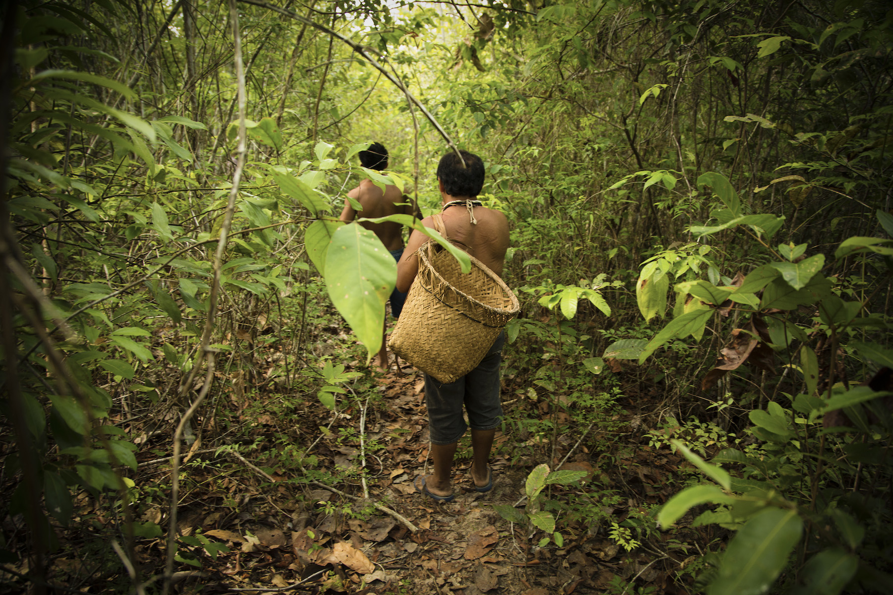
Photo credit: Walter Wust/Peru
The Community level data layers provide sub-national information at the scale of distinct indigenous or community lands. They include maps and data that are publicly available as well as information directly from individuals and organizations with their permission and the permission of the concerned Indigenous Peoples and communities as detailed in a data-sharing agreement. These layers display the boundaries of indigenous and community lands (polygon data) or, when boundaries are not available, point data showing the location of Indigenous Peoples, communities and/or their lands.
The geographic information displayed on LandMark is not complete. The Operational Team is involved in a collaborative and on-going effort to collect available maps of the boundaries of indigenous and community lands. The absence of data, however, does not indicate the absence of indigenous or community land (see Data Completeness). If you or your organization can help fill in the gaps in coverage, please contact us.
The community level data are post-process to conform to universal standard to the extent possible. This includes a common projection (WGS1984 Web Mercator Auxiliary Sphere) as well as a globally-consistent typology based on the identity and legal status of each indigenous and community land. This typology is used as a base reference for displaying the community level data on the platform, enabling comparisons of status within and across countries: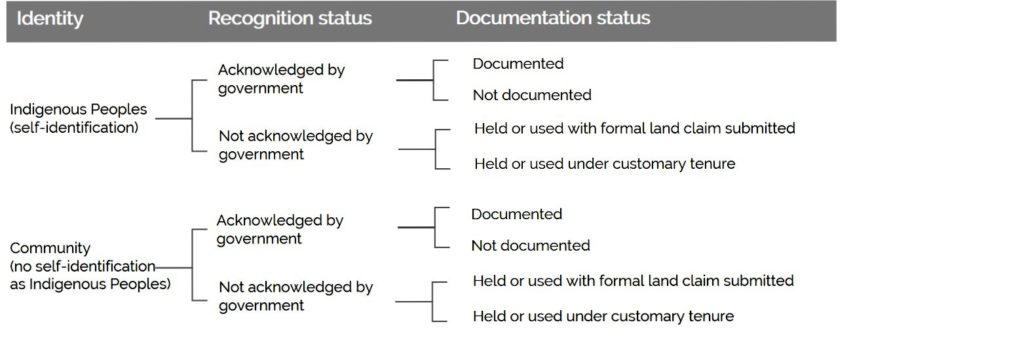
Definitions of Typology Terms
The following definitions apply for the purposes of categorizing, symbolizing, and displaying community level data on LandMark:
Identity: This category distinguishes between lands held or used by communities that self-identify as Indigenous Peoples and communities that do not. This distinction is made partly because Indigenous Peoples' rights to land and resources are specifically recognized in international law. If the community does not self-identify as Indigenous Peoples or there is not enough information available to make the distinction, then the land is classified as community land. (See Definitions).
A clear distinction between indigenous and non-indigenous lands can sometimes be difficult given the available information and because the community may include both Indigenous Peoples and non-Indigenous Peoples. In cases where it is unclear, the lands displayed on the platform default to community lands. Please contact us if you identify indigenous lands that are currently categorized on LandMark as community lands.
Acknowledged by government: The indigenous or community land is recognized in law as owned lands or as lands formally set aside for Indigenous Peoples or community occupation and use. Formally acknowledged lands are categorized into two classes of Documentation Status:
- Documented: The Indigenous Peoples or community have formal documentation of this land from the government (e.g., a title, registration, or other form of official documentation), including situations where: 1) formal documentation recognizing indigenous or community land rights has been extended and registered; 2) the government retains ownership of the land itself but has demarcated and formally set aside areas within which Indigenous Peoples or communities enjoy lawful occupation and use.
- Not documented: The Indigenous Peoples or community are recognized by government but do not hold formal documentation for various reasons, which could include situations where: 1) They are in the process of obtaining formal documentation and the process is not complete; 2) There is a lack of funding, political will or other circumstances such that the documentation process has not been initiated; 3) The national law recognizes indigenous and community land without formal documentation (although some Indigenous Peoples and communities obtain formal documentation to double-lock their land rights; in this case the land is categorized as titled); 4) There is no legal provision for documentation, and registrable title may only be obtained by surrendering the customary right in favour of issue of a statutory title such as leasehold or freehold.
Not acknowledged by government: The indigenous or community land is not recognized in law or formally set aside for Indigenous Peoples or community occupation or use. Unrecognized lands are categorized into two classes of Documentation Status:
- Held or used with formal land claim submitted: The Indigenous Peoples or community has filed a petition or other legal document with the government, including the court, to have their lands formally recognized.
- Held or used under customary tenure: The national legal framework does not permit or allow for recognition of indigenous/community lands or the Indigenous Peoples or community has not pursued formal recognition from the government.
Additional descriptive information is available for each indigenous or community land by clicking on the geographic feature in the interactive map. The information displayed in the attribute table is as follows:
| Attribute Table for Indigenous and Community Lands | |
|---|---|
| Name | What is the name of the selected indigenous or community land? |
| Country | In what country is the indigenous/community land located? |
| Identity | How does the community self-identify? As Indigenous Peoples or as non-indigenous community? When unclear or unknown, the land is presented as community land. |
| Recognition status | Is the indigenous or community land formally acknowledged by government in law or decree? |
| Documentation status (Date) | What is the documentation status of the land? For land that is acknowledged by government, there are two documentation status categories (see typology definitions above): - Documented - Not documented For indigenous or community lands that are not acknowledged by government, there are two documentation status categories: - Held or used with formal land claim submitted - Held or used under customary tenure (without formal land claim submitted) The date field displays the year that the land attained the specified documentation status (if known). |
| Status notes | Is there any additional information available to clarify the recognition or documentation status beyond the established typology? |
| Land category | What is the categorical name that the local state gives to this type of indigenous or community land? (e.g., reservation, indigenous territory, customary lands). |
| Ethnic groups | What are the names of the principal ethnic groups or communities that reside on the indigenous or community land? May include primary, secondary, and tertiary ethnic groups or communities based on population size. |
| Population (Source, Date) | How many people normally reside on the indigenous or community land? Includes the source and date of the estimate or census. |
| Land area, official and GIS | What is the official area of the indigenous or community land, as stated in the formal documents (only applies to formally recognized lands)? What is the area of the land as calculated in GIS? All areas are in hectares. |
| Acquisition scale | What is the scale at which the land data were collected or georeferenced? |
| Acquisition method | What was the method used to acquire the indigenous or community land data (e.g., hand-held GPS, transcribed from land title)? |
| Data source (Date) | Which individual or organization created the data that are shown on LandMark? May or may not be the same as the contributing institution. Includes date that data were created or last edited. |
| Data contributor | Which individual or organization provided the data to LandMark? |
| Date uploaded | The date that the data were posted on LandMark. |
| More info | A web link to more detailed information. |
| Additional notes | Additional notes to explain or clarify any information provided about the indigenous or community land |
Indicative Areas of Indigenous and Community Land Rights
The Indicative Areas of Indigenous and Community Land Rights layer shows areas where indigenous and community lands likely exist but the clear delimitation, recognition and/or documentation status of these land rights are not available at this time. In other words, there was not enough information available to fit the typology for the Community Level Data typology described above, but there is known presence of Indigenous Peoples and local communities. These maps will transition to the Indigenous Lands or Community Lands layer once more information becomes available.
Community Natural Resource Rights
The Community Natural Resources Rights layer displays areas where community groups have customary or formal legal rights to forests, rights to wildlife or hunting, or rights to pasture for herding and grazing. Areas displayed may have community rights to more than one natural resource and may be used differently according to the needs of communities. The legal agreements that formalize community rights to natural resources may also impact community activities within and across countries. For example, community forest resources may include rights to foraging and felling in some areas, or rights to small-scale logging in others
Data Providers
Many individuals and organizations have provided the data and information displayed on LandMark. The following tables provide the sources for the community level and national level data.
Community Level Data Providers
| Geographic Coverage | Data Provider | Citation | Source |
|---|---|---|---|
| Antigua and Barbuda | Government of Antigua and Barbuda, The Barbuda Land Act 2007; Global Administrative Areas (GADM), 2015. | Government of Antigua and Barbuda, The Barbuda Land Act 2007; Global Administrative Areas (GADM). 2015. Administrative Area of Barbuda. Downloaded from www.gadm.org on 2017/10/16. | The Barbuda Land Act 2007; Administrative area of Barbuda: www.gadm.org |
| Argentina (Indicative) | Instituto Nacional de Asuntos Indígenas | Instituto Nacional de Asuntos Indígenas. 2010. Distribución territorial de las Comunidades de los Pueblos Originarios de la República Argentina. | www.argentina.gob.ar/derechoshumanos/inai/mapa |
| Australia | Commonwealth of Australia (Geoscience Australia) | Geoscience Australia. 2018. National Public and Aboriginal Lands (NPAL) pre-1998. Geoscience Australia, Canberra. | www.ga.gov.au/metadata-gateway/metadata/record/42339/ |
| Australia | National Native Title Tribunal | National Native Title Tribunal. 2018. Register of Native Title Claims - boundaries and core attributes about application. National Native Title Tribunal, Australia. | www.ntv.nntt.gov.au/download/download.asp |
| Belize, Costa Rica, El Salvador, Guatemala, Honduras, Mexico, Nicaragua, Panama (Indicative) | International Union for Conservation of Nature (IUCN) | International Union for Conservation of Nature. 2016. Map of Indigenous People, Protected Areas and Natural Ecosystems in Central America. Regional Office for Mexico, Central America and the Caribbean. San José, Costa Rica. | www.iucn.org/mesoamerica/ |
| Bolivia (outside Amazon basin) | Instituto Nacional de Reforma Agraria (INRA) | Instituto Nacional de Reforma Agraria. 2012. Tierras Comunitarias de origen (TCO) tituladas por el Instituto Nacional de Reforma Agraria - INRA 2012. INRA, Bolivia. | geo.gob.bo/catalogapp/?any=tco |
| Bolivia (inside Amazon basin) | Fundação Amigos da Natureza (FAN), Sistema Nacional de Información para el Desarrollo (SNID), Instituto Nacional de Reforma Agraria (INRA) via Rede Amazônica de Informação Socioambiental Georreferenciada (RAISG) | Fundação Amigos da Natureza, Sistema Nacional de Información para el Desarrollo, Instituto Nacional de Reforma Agraria. 2016. Territorio Indigena Originario Campesino, as provided to RAISG. | https://www.amazoniasocioambiental.org/mapas/ |
| Botswana | Department of Surveys and Mapping, Government of Botswana | Department of Surveys and Mapping, Government of Botswana. 2002. Botswana National PC Atlas Land Tenure Data. Gaborone, Botswana. | By request: Government of Botswana. See www.atlas.gov.bw |
| Brazil (outside Amazon basin) | Fundação Nacional do Índio (FUNAI) | Fundação Nacional do Índio. 2014. Terra Indígena (Regularizada, Homologada, Declarada, Delimitada e Área em Estudo). FUNAI, Brasília. | www.funai.gov.br/index.php/shape |
| Brazil (inside Amazon basin) | Instituto Socioambiental (ISA) via Rede Amazônica de Informação Socioambiental Georreferenciada (RAISG) | Instituto Socioambiental. 2016. Terra Indígena, as provided to RAISG. | https://www.amazoniasocioambiental.org/mapas/ |
| Brazil | Instituto Nacional de Colonização e Reforma Agrária (INCRA) | Instituto Nacional de Colonização e Reforma Agrária (INCRA). 2015. Quilombos. INCRA, Brasília. | http://acervofundiario.incra.gov.br/i3geo/ (interactive GIS) |
| Cambodia | Open Development Cambodia (ODC) | Open Development Cambodia (ODC). 2018. Land titles of indigenous communities registered and issued by the Ministry of Land Management Urban Planing and Construction, from 2009 to 2018. Phnom Penh, Cambodia. | https://cambodia.opendevelopmentmekong.net/profiles/indigenous-communities/ |
| Cambodia (indicative) | Save Cambodia's Wildlife's Atlas Working Group as provided to Open Development Cambodia (ODC) | Save Cambodia's Wildlife's Atlas Working Group, Open Development Cambodia (ODC). 2015. Indigenous People Areas in Cambodia. Phnom Penh, Cambodia. | https://opendevelopmentcambodia.net/dataset/?id=map-indigenous-people-areas-in-cambodia |
| Cameroon, Democratic Republic of the Congo | Rainforest Foundation UK | Rainforest Foundation UK/MappingForRights, Brainforest, CADEM, CED, DGPA, Foder, GASHE, MEFP, OCDH, RRN. Community mapping survey area. 2020. | By request: mappingforrights@rainforestuk.org or http://www.mappingforrights.org/ |
| Cameroon, Central African Republic, Democratic Republic of the Congo, Gabon, Republic of the Congo (indicative) | Rainforest Foundation UK | Rainforest Foundation UK/MappingForRights. 2020. Presence of Indigenous Peoples [Administrative areas known to have the presence of indigenous peoples]. | By request: mappingforrights@rainforestuk.org or http://www.mappingforrights.org/ |
| Canada (British Columbia) | Ministry of Aboriginal Relations and Reconciliation - Intergovernmental and Community Relations | Ministry of Aboriginal Relations and Reconciliation - Intergovernmental and Community Relations. 2016. First Nations Treaty Lands - British Columbia. | https://catalogue.data.gov.bc.ca/dataset/first-nations-treaty-lands |
| Canada | Natural Resources Canada, Government of Canada | Natural Resources Canada. 2014. Aboriginal Lands - Canada. Government of Canada. | geogratis.gc.ca/api/en/nrcan-rncan/ess-sst/815dd99d-4fbd-47cc-be02-7ad4b03a23ec.html |
| Chile | Corporación Nacional de Desarrollo Indígena (CONADI) | Ministerio de Desarrollo Social de Chile, Corporación Nacional de Desarrollo Indígena (CONADI). 2015. Catastro Tierras y Aguas Indígenas 2015: Títulos de Merced. Temuco, Chile. | http://siic.conadi.cl/ |
| Chile (marine areas) | Subsecretaría de Pesca y Acuicultura | Subsecretaría de Pesca y Acuicultura. 2019. Espacios Costeros Marinos para Pueblos Originarios (ECMPO). Valparaíso, Chile. | Catálogo Nacional de Información Geoespacial |
| Colombia (outside Amazon basin) | Instituto Colombiano de Desarrollo Rural (INCODER) | Instituto Colombiano de Desarrollo Rural (INCODER). 2015. Resguardos Indígenas; Tierras de Comunidades Negras. INCODER, Bogota. | www.incoder.gov.co and http://sigotn.igac.gov.co/ (interactive GIS) |
| Colombia (inside Amazon basin) | Fundação Gaia Amazonas and Instituto Colombiano de Desarrollo Rural (INCODER) via Rede Amazônica de Informação Socioambiental Georreferenciada (RAISG) | FGA, INCODER. 2016. Resguardos Indígenas, as provided to RAISG. | https://www.amazoniasocioambiental.org/mapas/ |
| Costa Rica | El Observatorio del Desarrollo, Universidad de Costa Rica | El Observatorio del Desarrollo, Universidad de Costa Rica. 2008. Atlas digital de los pueblos indigenas. Universidad de Costa Rica. | pueblosindigenas.odd.ucr.ac.cr |
| Ecuador (outside Amazon basin) | EcoCiencia (Nacionalidades y Pueblos) | Consejo de Desarrollo de las Nacionalidades y Pueblos del Ecuador - CODENPE. 2013. Quito, Ecuador. | www.ecociencia.org |
| Ecuador (inside Amazon basin) | EcoCiencia and Ministerio del Ambiente via Rede Amazônica de Informação Socioambiental Georreferenciada (RAISG) | EcoCiencia, MAE. 2016. Nacionalidades and Zona Intangibles, as provided to RAISG. | https://www.amazoniasocioambiental.org/mapas/ |
| French Guiana | Direction Régionale de l'Environnement de Guyane (DIREN) via Rede Amazônica de Informação Socioambiental Georreferenciada (RAISG) | Direction Régionale de l'Environnement de Guyane. 2007. Zona de Derecho Colectivo para Comunidades Locales, as provided to RAISG. | https://www.amazoniasocioambiental.org/mapas/ |
| Greenland | Adam Worm, Deputy Head, Greenland Representation in Denmark; Jens Dahl, Adjunct Professor, Department of Cross-Cultural and Regional Studies, Center for Comparative Cultural Studies, University of Copenhagen; Global Administrative Areas (GADM). | Adam Worm, Deputy Head, Greenland Representation in Denmark (personal communication, 2015/09/21); Jens Dahl, Adjunct Professor, Department of Cross-Cultural and Regional Studies, Center for Comparative Cultural Studies, University of Copenhagen (personal communication, 2015/11/02). Global Administrative Areas (GADM). 2015. Administrative Area of Greenland. Downloaded from www.gadm.org on 2015/02/10. | Administrative area of Greenland: www.gadm.org |
| Guyana | Guyana Lands and Survey Commission (GLSC) | Guyana Lands and Survey Commission. 2019. Amerindian Lands. | https://glsc.gov.gy/ |
| India | Foundation for Ecological Security (FES) | Foundation for Ecological Security (FES). 2016. Community lands. Anand, India. | By request: gpicl@fes.org.in; brajesh@fes.org.in |
| Indonesia | Aliansi Masyarakat Adat Nusantara (AMAN) | Aliansi Masyarakat Adat Nusantara. 2015. Map of AMAN’s Members. Available from AMAN Database. | By request: rumahaman@cbn.net.id |
| Ireland | National Parks & Wildlife Service | National Parks & Wildlife Service. 2011. Commonage Agricultural Units shapefile. | www.npws.ie/maps-and-data/habitat-and-species-data |
| Kenya (Indicative) | RECONCILE; ILC Rangelands Initiative | Government of Kenya. 1999. Communal lands for five counties, as digitized by RECONCILE (2015). Nairobi, Kenya. | request: peterkenotieno009@gmail.com or shadrack@reconcile-ea.org |
| Malaysia (Sarawak) | Bruno Manser Fonds | Bruno Manser Fonds. 2015. Eastern Penan Communities of Sarawak. Sarawak, Malaysia. | Download shp |
| Mexico | Registro Agrario Nacional | Registro Agrario Nacional (RAN). 2016. Núcleos Agrarios. RAN, Mexico. | catalogo.datos.gob.mx/dataset/nucleos-agrarios-certificados |
| Mozambique | Centro Terra Viva (CTV) | Centro Terra Viva (CTV). 2018. Terras comunitarias (duats). Maputo, Mozambique. | Interactive GIS |
| Namibia | Directorate of Survey and Mapping, Ministry of Land Reform | Directorate of Survey and Mapping, Ministry of Land Reform, Government of Namibia. 2007. Communal Lands. Windhoek, Namibia. | By request. |
| New Zealand | Land Information New Zealand (LINZ) | Land Information New Zealand. 2012. NZ Primary Parcels. Government of New Zealand. | data.linz.govt.nz/layer/772-nz-primary-parcels/ |
| Nicaragua | El Gobierno Territorial Indígena Mayangna Sauni As (GTI-MSAs) | El Gobierno Territorial Indígena Mayangna Sauni As (GTI-MSAs). 2015. Territorial Indígena (digitized from CONADETI Titulo de Propiedad Comunal by WRI/WAIPT). Comunidad de Musawas Municipio de Bonanza, RAAN, Nicaragua. | Not available for distribution. |
| Nicaragua | Municipio de la Región Autónoma de la Costa Caribe Norte en Nicaragua | Municipio de la Región Autónoma de la Costa Caribe Norte en Nicaragua. 2018. Territorias Indígenas Tituladas. | By request. |
| Panama | Smithsonian Tropical Research Institute | Smithsonian Tropical Research Institute. 2012. Division Administrativa de la Rep. de Panamá. Panamá. | strimaps.si.edu/portal/home |
| Paraguay (polygon) | Servicio Nacional de Catastro, Grupo de Ayuda a los Totobiegosode, Instituto Paraguayo del Indígena, Dirección General de Estadísticas, Encuestas y Censo, and FAPI. | Servicio Nacional de Catastro, Grupo de Ayuda a los Totobiegosode, Instituto Paraguayo del Indígena, Dirección General de Estadísticas, Encuestas y Censo, and FAPI via Tierras Indígenas (Plataforma). 2017. Online at: http://tierrasindigenas.org.py. | Tierras Indígenas.org.py |
| Paraguay (point) | Dirección General de Estadísticas, Encuestas y Censo | Dirección General de Estadísticas, Encuestas y Censo. 2012. | Tierras Indígenas.org.py |
| Peru (outside Amazon basin) | Instituto del Bien Común | Instituto del Bien Común. 2018. Sistema de Información sobre Comunidades Nativas de la Amazonía Peruana (SICNA). Lima, Peru. | By request. See: www.ibcperu.org/servicios/sicna |
| Peru (inside Amazon basin) | Instituto del Bien Común via Rede Amazônica de Informação Socioambiental Georreferenciada (RAISG) | Instituto del Bien Común. 2018. Comunidades Nativas and Comunidades Campesinas, as provided to RAISG. | https://www.amazoniasocioambiental.org/mapas/ |
| Philippines | Philippine Association For Interculural Development, Inc. (PAFID); National Commission on Indigenous Peoples (NCIP) | Philippine Association For Intercultural Development, Inc. (PAFID), National Commission on Indigenous Peoples (NCIP). 2016. Ancestral Domains in the Philippines. | By request: pafid@yahoo.com |
| South Africa | Department of Rural Development and Land Reform | Department of Rural Development and Land Reform (DRDLR). 1994. South African Former Homelands. | Download shp |
| Spain | Montenoso | Montes veciñais en Man Común. 2009. Sistema de Información Territorial de Galicia. Xunta de Galicia. Shared by Montenoso. | Download shp |
| Suriname | Amazon Conservation Team (ACT) - Suriname (in partnership with communities) | Amazon Conservation Team - Suriname. 2019. Indigenous and Maroon Ancestral Lands in Suriname. | By request: info@amazonteam.org |
| Taiwan | Taiwan Indigenous Conserved Territories Union (TICTU) | Taiwan Indigenous Conserved Territories Union (TICTU). 2016. Reserved Lands of Indigenous Peoples and Traditional Territories of Indigenous Peoples. | Download geodatabase |
| Tanzania (Indicative) | Tanzania National Bureau of Statistics (NBS) and modified by WRI. | Tanzania National Bureau of Statistics (NBS), modified by WRI to exclude Protected Areas and urban areas. 2002. Village lands. | http://www.nbs.go.tz/ |
| United Kingdom (England) | Natural England | Natural England. 2013. Conclusive Registered Common Land (Crown Act 2000 - Section 4). | https://naturalengland-defra.opendata.arcgis.com/datasets/crow-act-2000-section-4-conclusive-registered-common-land |
| USA (Alaska) | U.S. Department of Interior, Bureau of Land Management | United States Dept. of Interior, Bureau of Land Management, Division of Support Services, Branch of Information Resource Management. 2015. Generalized ANCSA Selections; Generalized ANCSA Conveyances; Alaska Native Allotments - Digitized from MTP or Collected from Special Survey Plats using SDMS (COGO); Generalized Withdrawal for the Metlakatla Indian Reservation. Anchorage, AK. | sdms.ak.blm.gov |
| USA (Continental US and Hawaii) | U.S. Census Bureau | United States Census Bureau. 2015. TIGER/Line shapefile, American Indian/Alaska Native/Native Hawaiian Area (AIANNH). Washington, DC. | www.census.gov/geo/maps-data/data/tiger.html |
| Venezuela | Wataniba, Provita, IVIC, Ministerio del Poder Popular para la Salud via Rede Amazônica de Informação Socioambiental Georreferenciada (RAISG) | Wataniba, Provita, IVIC, Ministerio del Poder Popular para la Salud. 2015. Areas Indígenas, Territorios indígenas autodemarcados, Comunidades indígenas demarcadas, as provided to RAISG. | https://www.amazoniasocioambiental.org/mapas/ |
| Zambia | Ministry of Lands, Natural Resources and Environmental Protection | Ministry of Lands, Natural Resources and Environmental Protection. 2016. Customary land boundary, National Spatial Data Infrastructure of Zambia. Lusaka, Zambia. | By request. www.nsdi.mlnrep.gov.zm |
| Zimbabwe | Government of Zimbabwe | Government of Zimbabwe. (undated). Communal land boundaries. Harare, Zimbabwe. | By request. |
The platform itself may be cited as: LandMark. 2020. LandMark: The Global Platform of Indigenous and Community Land. Available at: http://www.landmarkmap.org/.
Community Natural Resource Rights Data Providers
| Geographic Coverage | Natural Resource Right | Data Provider | Citation | Source |
|---|---|---|---|---|
| Afghanistan (portion) | Community grazing/pasture rights | Solidarités International (SI) | Solidarites International. 2013. 22 Community Pastures in Afghanistan. SI, Afghanistan. | Download shp |
| Cambodia | Community hunting/wildlife rights | Open Development Cambodia (ODC) | Open Development Cambodia (ODC). 2020. Community fisheries, fish sanctuaries, flooded forests, fisheries conservation areas. Phnom Penh, Cambodia. | https://data.opendevelopmentcambodia.net/dataset/fishery?type=dataset |
| Cambodia | Community forest rights | Open Development Cambodia (ODC) | Open Development Cambodia (ODC). 2016. Community forestry (2008-2017). Phnom Penh, Cambodia. | https://data.opendevelopmentcambodia.net/dataset/community-forestry-2008-2014?type=dataset |
| Cameroon | Community forest rights | Forest Atlas of Cameroon / l'Atlas forestier du Cameroun | Forêts communautaires: Donnée publiées par l'Atlas Forestier du Cameroun, téléchargée le 2020/04/01. Community forests: Data published by the Forest Atlas of Cameroon, downloaded on 2020/04/01. | http://cmr-data.forest-atlas.org/datasets/community-forests |
| Canada | Community hunting/wildlife rights | Crown-Indigenous Relations and Northern Affairs Canada, Government of Canada | Crown-Indigenous Relations and Northern Affairs Canada, Government of Canada. Post-1975 Treaties (Modern Treaties) and Pre-1975 Treaties (Historic Treaties). 2015. Gatineau, Canada. Downloaded on 2020/12/21. | https://open.canada.ca |
| Democratic Republic of the Congo | Community forest rights | Forest Atlas of the Democratic Republic of the Congo / l'Atlas Forestier de la République Democratique du Congo (Various sources) | Forêts communautaires: Donnée publiées par l'Atlas Forestier de la République Democratique du Congo, téléchargée le 2018/08/20. Community forests: Data published by the Forest Atlas of the Democratic Republic of Congo, downloaded on 2018/08/20. | cod.forest-atlas.org |
| Equatorial Guinea | Community forest rights | Forest Atlas of Equatorial Guinea | Community forests: Data published by the Forest Atlas of Equatorial Guinea, downloaded on 2020/04/01. | http://gnq-data.forest-atlas.org/datasets/bosques-comunales?showData=true |
| Finland | Community grazing/pasture rights | Nordregio | Nordregio. 2015. Reindeer Herding Area in the Nordic Countries. Stockholm, Sweden. As used in Garnett et al. 2018. A Spatial Overview of the Global Importance of Indigenous Lands for Conservation | https://nordregio.org/maps/reindeer-herding-area-in-the-nordic-countries/ |
| Gabon | Community forest rights | Forest Atlas of Gabon / l'Atlas forestier de la République du Gabon | Forêts communautaires: Donnée publiées par l'Atlas Forestier du Gabon, téléchargée le 2020/04/01. Community forests: Data published by the Forest Atlas of Gabon, downloaded on 2020/04/01. | http://gab-data.forest-atlas.org/datasets/forets-communautaires |
| Iran | Community grazing/pasture rights | Centre for Sustainable Development (CENESTA) / Union of Indigenous Nomadic Tribes of Iran (UNINOMAD) | Centre for Sustainable Development (CENESTA) / Union of Indigenous Nomadic Tribes of Iran (UNINOMAD). 2015. Pilot territories of indigenous nomadic tribes of Iran. Tehran, Iran. | Not available for distribution. |
| Kenya | Community forest rights | UN Environment Programme World Conservation Monitoring Centre (UNEP-WCMC) | UNEP-WCMC (2020). Protected Area Profile for Kenya from the World Database of Protected Areas, April 2020. Available at: www.protectedplanet.net | https://www.protectedplanet.net/ |
| Liberia | Community forest rights | Liberia Forestry Development Authority | Community forests: Data published by the Forest Atlas of Liberia, downloaded on 2020/04/01. | http://lbr-data.forest-atlas.org/datasets/community-forests |
| Malawi | Community forest rights | Department of Forestry Malawi | Department of Forestry Malawi. 2017. Malawi Village Forest Associations. Lilongwe, Malawi. | By request: http://www.dof.gov.mw/ |
| Myanmar | Community forest rights | The Center for People and Forests (RECOFTC) | The Center for People and Forests (RECOFTC). 2017. Data Panel. Naypyitaw, Myanmar. | http://cfmyanmar.org/ |
| Namibia | Community forest rights | UN Environment Programme World Conservation Monitoring Centre (UNEP-WCMC) | UNEP-WCMC (2020). Protected Area Profile for Namibia from the World Database of Protected Areas, April 2020. Available at: www.protectedplanet.net | https://www.protectedplanet.net/country/NA |
| Namibia | Community hunting/wildlife rights | NASCO (Namibian Association of CBNRM Support Organizations) | NASCO (Namibian Association of CBNRM Support Organizations). 2017. Community Forests. | http://the-eis.com/ |
| Nepal | Community forest rights | 1. Department of Forests and Soil Conservation 2. International Centre for Integrated Mountain Development (ICIMOD) | 1. Department of Forests and Soil Conservation, Ministry of Forests and Environment, Government of Nepal. 2018. Community forests. Kathmandu, Nepal. 2. International Centre for Integrated Mountain Development (ICIMOD), Asian Network for Sustainable Agriculture and Bioresources (ANSAB) and Federation of Community for Forest Users of Nepal. 2010. Community Forest Boundaries. Kathmandu, Nepal. | Interactive GIS ICIMOD Regional Database system |
| Norway | Community grazing/pasture rights | Nordregio | Nordregio. 2015. Reindeer Herding Area in the Nordic Countries. Stockholm, Sweden. As used in Garnett et al. 2018. A Spatial Overview of the Global Importance of Indigenous Lands for Conservation | https://nordregio.org/maps/reindeer-herding-area-in-the-nordic-countries/ |
| Russia | Community grazing/pasture rights | Nordregio | Nordregio. 2015. Reindeer Herding Area in the Nordic Countries. Stockholm, Sweden. As used in Garnett et al. 2018. A Spatial Overview of the Global Importance of Indigenous Lands for Conservation | https://nordregio.org/maps/reindeer-herding-area-in-the-nordic-countries/ |
| Sweden | Community grazing/pasture rights | Nordregio | Nordregio. 2015. Reindeer Herding Area in the Nordic Countries. Stockholm, Sweden. As used in Garnett et al. 2018. A Spatial Overview of the Global Importance of Indigenous Lands for Conservation | https://nordregio.org/maps/reindeer-herding-area-in-the-nordic-countries/ |
| Tanzania | Community hunting/wildlife rights | UN Environment Programme World Conservation Monitoring Centre (UNEP-WCMC) | UNEP-WCMC (2020). Protected Area Profile for United Republic of Tanzania from the World Database of Protected Areas, April 2020. Available at: www.protectedplanet.net | https://www.protectedplanet.net/ |
| Uganda | Community hunting/wildlife rights | UN Environment Programme World Conservation Monitoring Centre (UNEP-WCMC) | UNEP-WCMC (2020). Protected Area Profile for Uganda from the World Database of Protected Areas, April 2020. Available at: www.protectedplanet.net | https://www.protectedplanet.net/ |
| Zambia | Community forest rights | USAID TetraTech ILRG | Integrated Land and Resource Governance (USAID Tetra Tech ILRG). 2019. Community-Based Forest Management Program, Zambia. Arlington, USA. | By request. |
Large-Scale Land Acquisitions
The Land Matrix. "Deals, Areas and Locations datasets." Last modified [2021/12/02]. [https://landmatrix.org/].
National Level Data Providers
National level data are generated from research (e.g., legal reviews, literature reviews, interviews), expert knowledge, and spatial data analysis. Lists of primary sources and methods are available in the National Level Data and Methods tab, or in the attribute table accessible by clicking on the geographic features in the interactive map. The data providers for these layers are:
Percent of Indigenous and Community Lands
| Geographic Coverage | Data Provider | Availability |
|---|---|---|
| Africa | Liz Alden Wily, Independent Land Tenure Specialist | Download data |
| Americas, Asia, Europe, Oceania | Fabrice Dubertret, World Atlas of Indigenous Peoples' Territories |
Cite as: F. Dubertret and L. Alden Wily. 2017. Percent of Indigenous and Community Lands. Data file from LandMark: The Global Platform of Indigenous and Community Lands. Available at: www.landmarkmap.org.
Indicators of the Legal Security of Indigenous and Community Land
| Geographic Coverage | Data Provider | Availability |
|---|---|---|
| Angola, Burkina Faso, Botswana, Chad, Côte d'Ivoire, Eritrea, Ethiopia, Gabon, Gambia, Ghana, Kenya, Lesotho, Liberia, Malawi, Mozambique, Namibia, Nigeria, Rep. of Congo, Rwanda, Sierra Leone, South Africa, South Sudan, Sudan, Swaziland, Tanzania, Uganda, Zambia, Zimbabwe | Liz Alden Wily, Independent Land Tenure Specialist | Download data |
| Argentina, Australia, Austria, Bangladesh, Belarus, Belgium, Belize, Bulgaria, Canada, Cambodia, Chile, China, Costa Rica, Cuba, Czech Republic, Denmark, Ecuador, Estonia, Finland, French Guiana, Germany, Greenland, Guyana, Honduras, Hungary, Iceland, India, Indonesia, Iraq, Italy, Jordan, Kazakhstan, Kyrgyzstan, Laos, Latvia, Lithuania, Macedonia, Malaysia, Mexico, Mongolia, Myanmar, Nepal, Netherlands, New Zealand, Nicaragua, Norway, Pakistan, Panama, Papua New Guinea, Paraguay, Poland, Portugal, Romania, Russia, Saudi Arabia, Slovakia, Spain, Sri Lanka, Suriname, Sweden, Switzerland, Tajikistan, Thailand, Turkey, Turkmenistan, Ukraine, United States, Uruguay, Uzbekistan, Vietnam | Nicholas Tagliarino, World Resources Institute |
|
| Bolivia, Brazil, Colombia, Peru | Adriana Vidal, Independent Land Tenure and Natural Resource Specialist | |
| Cameroon | Teodyl Nkuintchua, Natural Resource Specialist, Cameroon & Liz Alden Wily, Independent Land Tenure Specialist | |
| Central African Republic | Yves Delor Moussa Faculty of Legal and Political Science (FLPS), Bangui University |
|
| China, Haiti, Ireland, Israel, Jamaica, Oman, Singapore, Syria, United Kingdom, Venezuela, Yemen | Harvard Law and International Development Society (LIDS) | |
| Libya | Dr. Suliman Ibrahim, Director, Centre for Law and Society Studies, Benghazi University, Libya | |
| Madagascar | Roméo Léandre Tsioritolotra, with translation by Hasiniavo Rasolohery, DELC, Madagascar | |
| Mauritania | Prof. M. Baro, Arizona State University, with Liz Alden Wily, Independent Land Tenure Specialist | |
| Philippines | Celine Salcedo-La Viña, World Resources Institute |
|
| Timor-Leste | Bernardo Almeida, PhD Candidate, Leiden University, The Netherlands |
Cite as: L. Alden Wily, N. Tagliarino, Harvard Law and International Development Society (LIDS), A. Vidal, C. Salcedo-La Vina, S. Ibrahim, and B. Almeida. 2017. Indicators of the Legal Security of Indigenous and Community Lands. Data file from LandMark: The Global Platform of Indigenous and Community Lands. Available at: www.landmarkmap.org.
Indigenous Population per Country
Cite as: Dubertret, F. (2020). Recension des peuples autochtones du monde par pays. Data file from LandMark: The Global Platform of Indigenous and Community Lands based on Annex 1 of "Rendre explicite une présence invisible: Vers un atlas mondial des territoires autochtones". PhD thesis. IHEAL-CREDA, Université Sorbonne Nouvelle. 446 p. Available at: https://tel.archives-ouvertes.fr/tel-03426280.
Downloadable data
National level data are downloadable as spreadsheets in Excel (xls) format. Data are generated from research (e.g., legal reviews, literature reviews, interviews), expert knowledge, and spatial data analysis. Lists of primary sources and methods are available in the National Level Data and Methods tab, or in the attribute table accessible by clicking on the geographic features in the interactive map.
Some Community level data are downloadable through LandMark while other data are accessible via the original source website or contact information. All of the information about download availability is located in the Data Providers tab. The entire LandMark Community level data set is not available for download due to varying data sharing agreements with data providers.
Percent of Indigenous and Community Lands
Cite as: F. Dubertret and L. Alden Wily. 2015. Percent of Indigenous and Community Lands. Data file from LandMark: The Global Platform of Indigenous and Community Lands. Available at: www.landmarkmap.org.
Indicators of the Legal Security of Indigenous and Community Land
Cite as: L. Alden Wily, N. Tagliarino, Harvard Law and International Development Society (LIDS), A. Vidal, C. Salcedo-La Vina, S. Ibrahim, and B. Almeida. 2016. Indicators of the Legal Security of Indigenous and Community Lands. Data file from LandMark: The Global Platform of Indigenous and Community Lands. Available at: www.landmarkmap.org.
Indigenous Population per Country
Cite as: Dubertret, F. (2020). Recension des peuples autochtones du monde par pays. Data file from LandMark: The Global Platform of Indigenous and Community Lands based on Annex 1 of "Rendre explicite une présence invisible: Vers un atlas mondial des territoires autochtones". PhD thesis. IHEAL-CREDA, Université Sorbonne Nouvelle. 446 p. Available at: https://tel.archives-ouvertes.fr/tel-03426280.